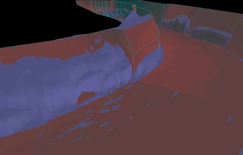
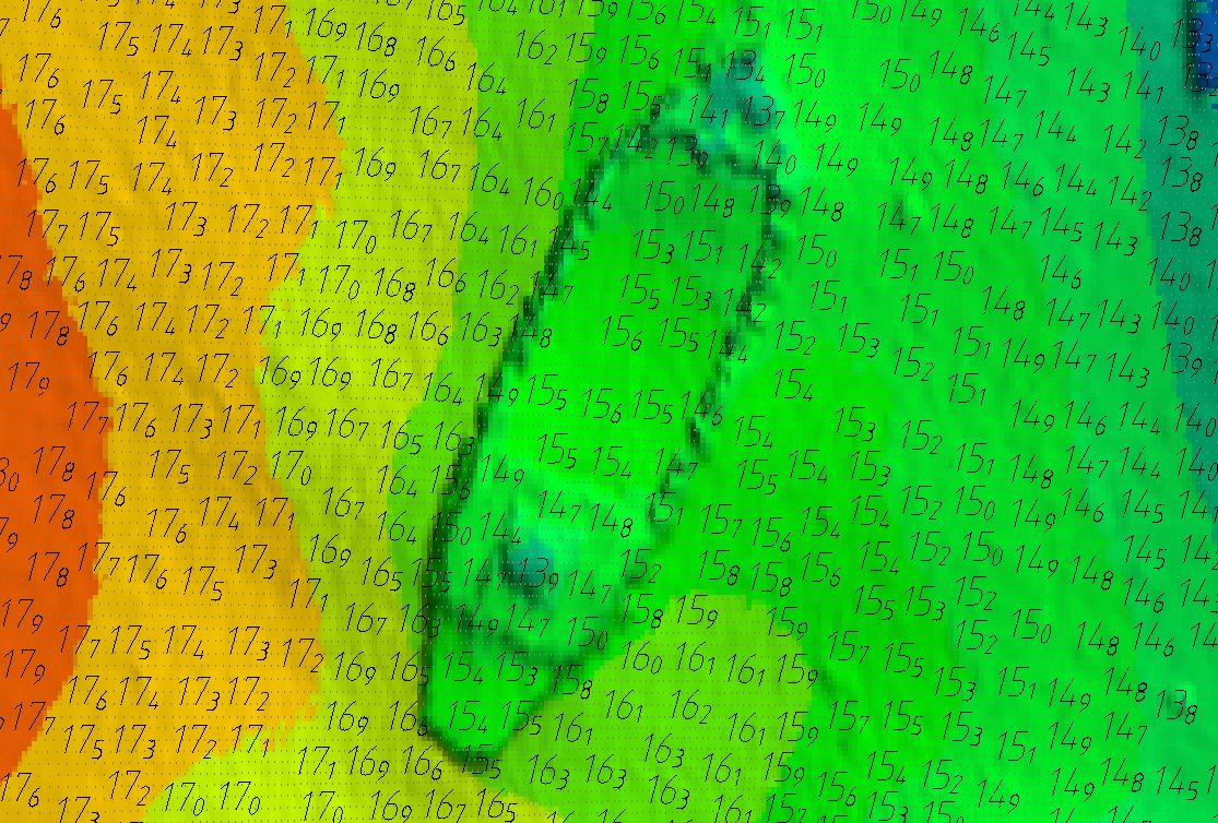
Terramodel HDMS Terramodel HDMS Hydrographic Data Management System is a suite of tools used for processing hydrographic data within Terramodel. HDMS is developed by Geocomp Systems and is also available from major hydrographic equipment suppliers. Features Adds on to TerramodelCustomised for GeoNav, Trimble HydroPro, Reson and other hydrographic systemsImports depths, runlines, trackplot lines and events from hydrographic data in many formatsImports and Exports detail and scenery files such as coastlines in various formatsRunline LabelsTrackplot LabelsEvent LabelsExports Data to Dredge SystemsUser guide A channel shown in Terramodel Visualizer Hydrographic depth labelling Easy to useHydrographic Office style labelling optionEach user-defined depth range can be assigned its own depth labelling options and text attributesUser defined depth text attributes include:fontcolourplacementorientationvariable rounding of depth values A shipwreck showing all points, a shaded and coloured surface and depths after removing clashing Depth Clashing / Depth Weeding / Depth Text Overwrite RemovalEasy to useExceptionally fast (typically 1000 depths processed per second)User-defined parameters including clashing width, text height and orientation Data Binning to sample or decimate dataBinning optionsShoalest depthDeepest DepthAverage DepthTIN Surface depthBin Depth location optionsCentre of each binRetain position of soundingStatistical OptionsDepth range (Max – Min) in each BinStandard Deviation in each Bin ContactTo find out more, please contact us See Also Terramodel GeoCalc GCGeoCode